недеља, 22. март 2009.
MAPTECH DIGITAL CHART KIT PR AND US VI
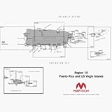
Digital Chart Kit Puerto Rico and US Virgin Islands Contains all NOAA Charts in the title area, Coastal Topo Maps, Selected Navigation Photos, Aerial Pictures, Tides, Light Lists, Coast Pilot, Facilities are not included, Chart Navigator. The charts are BSB4 format-make sure your software is compatible. Digital ChartKit Digital ChartKit has all the software you need to get started in PC navigation. Each region includes GPS navigation software and charts on CD-ROM. Plan Before You Go Digital ChartKits include Offshore Navigator GPS planning and chartplotting software. Route planning is as simple as clicking a mouse. Click, and youve put the first waypoint on the chart. Click again and youre creating a route. Its that easy. Print Print route plans, tide and current graphs, and chart packets on standard home or office printers. GPS Ready Digital ChartKits include Offshore Navigator GPS planning and chartplotting software. Offshore Navigators GPS features include: - Real-Time Positioning - Data Windows - Transfer Waypoints from PC to GPS Official NOAA Charts Outside the U.S., Maptech offers digital charts in partnership with leading hydrographic offices and private cartographers around the world. Navigation Photos Overhead Navigation Photos match chart positions exactly and provide a useful aid in understanding charts. You can view them full-screen or side-by-side with charts. Aerial Pictures Full-color pictures of harbors, approaches and k
Пријавите се на:
Објављивање коментара (Atom)
Нема коментара:
Постави коментар